

GeoticCAD 1.11.5
GeoticCAD 1.11.5 | 191 Mb
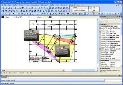
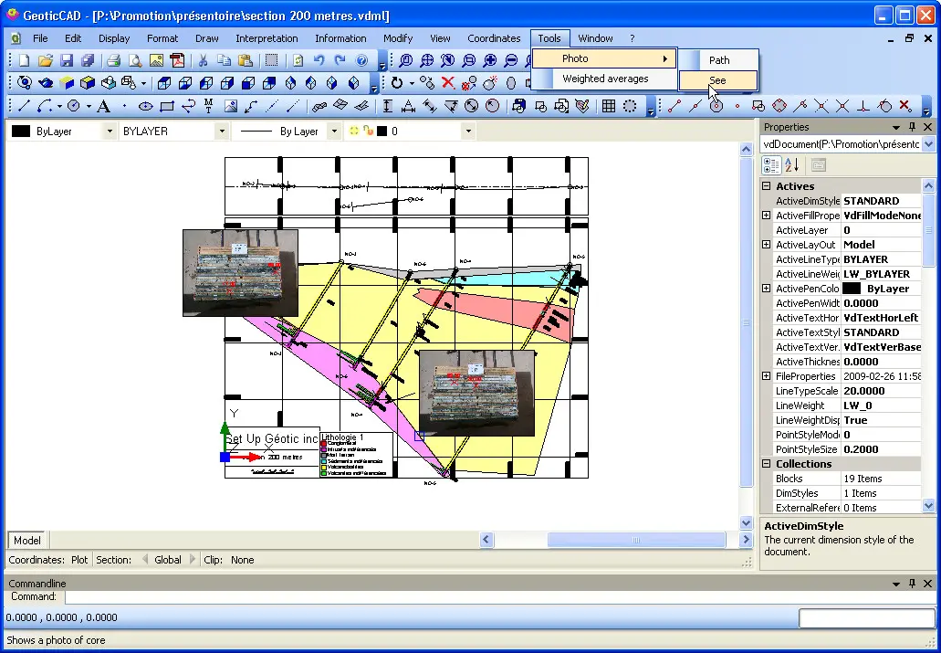
Similar to AutoCAD, GeoticCAD will provide you with a familiar work environment, thus reducing your learning curve. The software stands out from many competitor products thanks to its own integrated drawing motor. You do not need to install AutoCAD, which translates into increased autonomy and reduced costs.
Not only does GeoticCAD work with all the formats supported by GeoticGraph (JPG, PNG, DWG, TIF, PGN…), but its main strength lies in the use of Geotic’s own VDML file format, which optimizes your possibilities. For example, several sections can be combined simply and automatically into one drawing without having to worry about insertion points.
Complicated rotations will be a thing of the past since GeoticCAD automatically recognizes all the systems (World, Measure and Plot) defined when creating sections with GeoticGraph, and allows you to move from one system to another with a simple click.
It is easy to visualize individual sections when you add your geological interpretation, by making the neighbouring section/s appear in grey. You can complete your drawing by including an arrow pointing north, a graphical scale or a legend explaining the colour codes used when creating your sections or by importing graphical elements from other sources such as AutoCAD or Gemcom.
Features:
User-friendly and intuitive environment under Windows 10 or more
Trilingual (English, French, Spanish)
Optimized to use sections drawings in the GeoticGraph VDCL 3D format
Insertion of legends, graphic scales, and wind rose
Simple movement between the 3 coordinate systems (World, Measure and Plot)
Export to image format
Export to PDF format respecting a sacle
Export to DWG and DGN formats (AutoCAD and Micro Station software are not required)
Automatic interpretation of the topography and the bedrock
System Requirements:
CPU Speed: 1.5 GHz, single-core minimum ~ Recommended: Intel 2.0 GHz dual-core, 64 bits, or better
RAM : 2 GB minimum ~ Recommended: 4 GB or more
OS: Microsoft Windows 10 or more recent ~ Recommended: 64 bits
Display: Dimensions of 1024x768 or more
Home Page - https://www.geotic.ca/en/geoticcad