
SkyDemon 4.1.0.101
SkyDemon 4.1.0.101 | 9.5 Mb
SkyDemon will help give you the confidence to fly further and to more interesting places. Plan a journey, brief yourself on potential hazards, prepare for flight and analyse your track logs. Live briefing data includes NOTAM, airfield documents and maps, TAF, METAR and wind forecasts at altitude.
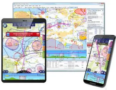
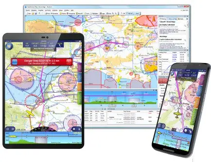
Dynamic Vector Charts
Our charts are widely recognised as being the clearest aeronautical charts available. They are entirely bespoke, created by us every 28 days (at least) directly from raw aeronautical data published by the countries we cover. This means that wherever you fly, the look and feel of your chart is consistent.
Comprised of many individually selectable layers and adjustable to your preferences, they show you only what you need to see and nothing else. Unlike printed charts, a SkyDemon chart is aware of your plans and can dynamically hide airspace and other features not relevant at the levels you are flying. This makes it much easier to interpret, and as a result, safer.
There is a high level of interactivity in our charts. Many details which might in the past have been written permanently on your map are now completely hidden until asked for, by simply moving the mouse or touching with your finger. Practically every charted item can reveal extra information, whether it's the vertical boundaries or activity times of airspace, the frequencies for an airfield or the height of a ground-based obstruction.
Operating System: Windows 7, 8/8.1, 10, 11
Home Page - https://www.skydemon.aero/